Waterside Walk
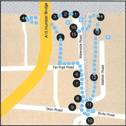
In the 19th and early 20th century the Waterside was an almost self-sufficient, close-knit community with its own shops, school, church and Methodist chapel, inns and industries. Many of its residents rarely ventured into central Barton but instead used the railway and ferry to visit Hull. Its industries included the manufacturing of bricks and tiles, ropes, chemicals and boats. There were malt kilns, a whiting mill and a gas works.
Begin the walk at the Humber Bridge Viewing Area …
1. The Boathouse
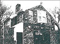
The Boathouse was originally a coastguard station, opened by the then Duke of Edinburgh in 1880, but closed in the 1920. During the Second World War it was used by an army unit. It is now a cafe and the start of the Viking Way, a long distance walk which ends at Oakham.
Head West along the Humber bank to the top of the car park steps …
2. The Humber
From this point you get a panoramic view across the Humber. Barton Ferry, mentioned in the Domesday Book, sailed between Barton and Hessle until the 1850’s. It was one of several ferries crossing the Humber. A freight service operated between Barton Haven and the Horsewash in Hull until the 1950’s. Hessle, with its church can be seen from here. At low tide, particularly in autumn and winter, the mud supplies rich feeding for wading birds.
Continue West along the Humber Bank – ahead of you is a bridge! …
3. The Humber Bridge
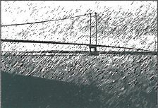
The building of the Humber Bridge commenced in 1972 and it was officially opened by Queen Elizabeth II on 17 July 1981. It is one of the world’s longest suspension bridges, having a total length of 2,220 metres (2,430 yards). The bridge is operated by the Humber Bridge Board, formed by an Act of Parliament in 1959.
Continue along the Humber Bank – on your left …
4. The Tile Works
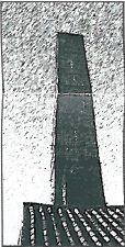
In 1900 there were 15 brick and tile yards in the parish producing both bricks and tiles. The products were sent from wharves on the Humber Bank all over eastern England, and many houses in London’s suburbs are roofed with Barton tiles. Many of the workers in the industry lived in cottages built in the yards. The industry has steadily declined since the First World War. The many remaining ponds, marking the pits from which the clay was extracted, are evidence of its former importance in the economy of the town. The Tile Works, while still producing traditional local pantiles, now also houses a popular cafe and garden centre.
Continue along the Humber Bank for another 200 metres …
5. Far Ings Visitor Centre
The pits and reedbeds at Far Ings and along the Humber bank are a legacy of the tile and cement industry which flourished between 1850 and 1959. Thanks to pioneering management by the Lincolnshire Wildlife Trust, the reserve is now rich in wildlife and one of the UK strongholds for bittern. There is a popular Visitor Centre and many hides throughout the reserve. With luck you may hear a bittern booming.
Turn left through the nature reserve to Far Ings Road. Turn left back towards Barton under the Humber Bridge …
6. Far Ings Road
The terraces on Far Ings Road were built in the late 19th century as housing mostly for local cement workers.
At the junction with Waterside Road turn right ..
7. Wesleyan Chapel
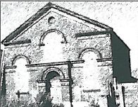
The Wesleyan Chapel, built in 1862 as a Mission Chapel, was designed by the Hull architect W Alfred Gelder. The original Mission Chapel on the south side of the site was converted into a Sunday School when the new chapel was opened. The building has since had many different uses.
Continue along Waterside Road to the Junction with St Chads Way …
8. St Chads Church
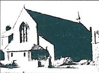
Many buildings along Waterside have now been demolished. Among them was St. Chad’s Church whose foundation stone was laid on 1 June 1902 by the Bishop of Lincoln. It cost £1,850 to build, was closed for worship in 1970, and finally demolished in 1993.
Continue along Waterside Road …
9. 23 – 25 Waterside Road
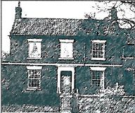
Nos. 23 – 25 Waterside were originally one house which belonged to the owner of the windmill situated to the north-west. It was built in the early 19th century. The Turnpike road from Barton-Waterside to Lincoln started from here and was opened in 1765.
Look to the right behind the house …
10. Hewsons Mill
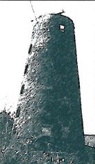
The Tower of Hewson’s Mill is the only one remaining of the three mills which formerly worked along Waterside Road. It was built in 1813 for Messrs Cook and Sutton and was used to grind grain. There were four windows on each floor and it was whitewashed on the inside and tarred on the outside.
Continue along Waterside Road to Dam Road …
11. Dam Road
Dam Road, formerly the site of a dam which provided water for a mill at the head of the Haven was once known as ‘First Ings’ and later as ‘Gas House Lane’. In 1846, the Barton Gas Works was built here. Its coal supplies were brought to the Haven by boat. Substantial houses, such as Clarence House and Yuba House, were built for brickyard owners and have fine, detailed brickwork.
Return to Waterside Road and continue …
12. The White Swan
The White Swan Inn was formerly one of Barton’s main hotels. It is a three-storeyed building with a steeply hipped pan tile roof. The ‘Venetian’ windows looking onto Fleetgate indicate that it was built in the 18th century. It formerly had stabling and a paddock at the rear.
Cross the road and head back towards the Humber …
13. Barton on Humber Station
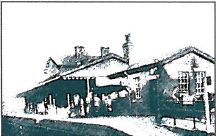
The Railway Station was opened by the London North Eastern Railway in 1855 though trains had reached Barton in 1849. It was formerly a very busy place with a lot of freight and passenger traffic. In 1901, fourteen trains left Barton each weekday and four on Sundays. The station buildings were all demolished in 1973. There is still a service from Barton to Grimsby and Cleethorpes operating from a single unmanned platform.
Continue along Waterside Road and turn right into Maltkins Lane. Cross the supermarket car park on your left …
14. The Ropewalk
John Hall (1775 – 1863) developed the Ropery which became known as John Hall & Co. By 1900 about half of the ropes produced there were sold to the largest private ship owners in the world at that time, and the remainder went to trawler companies in Hull, Grimsby and Lowestoft. The firm expanded greatly during the early years of the twentieth century and made significant contribution to the war effort in both world wars but gradually trade declined and the Ropery closed in 1989. There now remains to be seen the old ropewalk -reputed to have one of the longest pan-tile roofs in the country, some quarter of a mile long – and the former despatch building with its mansard roof and loading crane. The ropewalk building was refurbished and opened as Ropewalk Contemporary Arts & Crafts Gallery in April 2000 and now contains a popular cafe and a music venue. The despatch building is now a Day Spa.
Walk alongside The Ropewalk and, at the end, turn right across Maltkiln Lane …
15. Water’s Edge Country Park
This is a Country Park incorporating wetland, mixed woodland planting, wild flower rough meadow and access pathways including a boardwalk. There is ample parking and a walkway link to the Ropewalk. The Country Park is linked to the west side of the Haven by a footbridge giving access to the Humber Bridge Viewing Area, car park and the length of the Humber bank. The Country Park was created in the late 1990s from an area previously blighted by post-industrial dereliction and contamination. Previously the industrial site at the mouth of the Haven had incorporated a large malting and a factory producing fertilisers.
Continue to the Humber Bank …
16. Water’s Edge Visitor Centre
Waters’ Edge Visitors Centre. Opened in 2006 to complement the Country Park, it incorporates the most progressive environmental techniques in its construction. It is a base for some local businesses and for estuary-wide environmental agencies. The centre houses interactive displays on themes such as local wildlife, climate and geography.
On the right outside the visitor centre …
17. Barton Haven
There were once boat Landings along the banks of the Barton Haven all the way down Waterside. Barton was a great port in the medieval period and, although that declined somewhat in the 16th and 17th centuries, a revival in its fortunes took place in the 18th and 19th centuries when goods, including bricks, tiles, whiting, chalk, gravel, sugar beet, fertiliser, barley, coal, rope, hemp, were transferred to and from sloops, keels, coasters and London sprit-sail barges. These traded with inland, coastal and continental ports via the River Humber. Many of the sailors who manned these boats lived in the houses and streets which lined Waterside. Most of the river trading finally ceased with the outbreak of the Second World War but a market boat continued to journey from Barton Haven to Hull until the late 1950s.
Cross the footbridge back to Waterside Road and turn right …
18. Waterside House
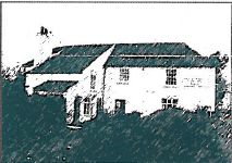
Waterside House was originally known as Waterside Inn and dates from 1715. During its heyday from about 1723 to 1835, the Inn must have been a most important and prestigious establishment with three mail coaches daily using it, running to a regular timetable. The Royal Mail coach to London ran daily from here. In 1821, when a steam ferry commenced running between Hull and Barton, the Inn had stabling for 100 horses. The mail coaches stopped running when the New Holland ferry and rail connection opened in 1849. The Inn became a ferry office and was later converted to a public house much frequented by the boatmen using Waterside. The building now houses an ice cream parlour.
Continue towards the Humber ….
19. Coastguard Cottages
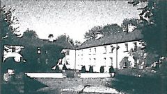
The eight Coastguard Houses were built by Alexander Stamp in 1862 for William Wilkinson, surgeon, of Cob Hall. They were houses for the families of the seven boatmen and one leading boatman, with a communal washhouse serving all the dwellings. These coastguards had previously lived in houses on Waterside Road. The Admiralty originally leased the houses from Wilkinson for 21 years, but bought the properties on his death in 1883. The coastguards launched their boat from the old jetty which had been built in 1825 for the new steam ferry. For over a century, Barton’s coastguard station was the headquarters of the service along the Humber. The jetty was demolished in 1929 when the station was closed.
Continue right to the very end of Waterside Road and turn left back to the Humber Bridge Viewing Area